
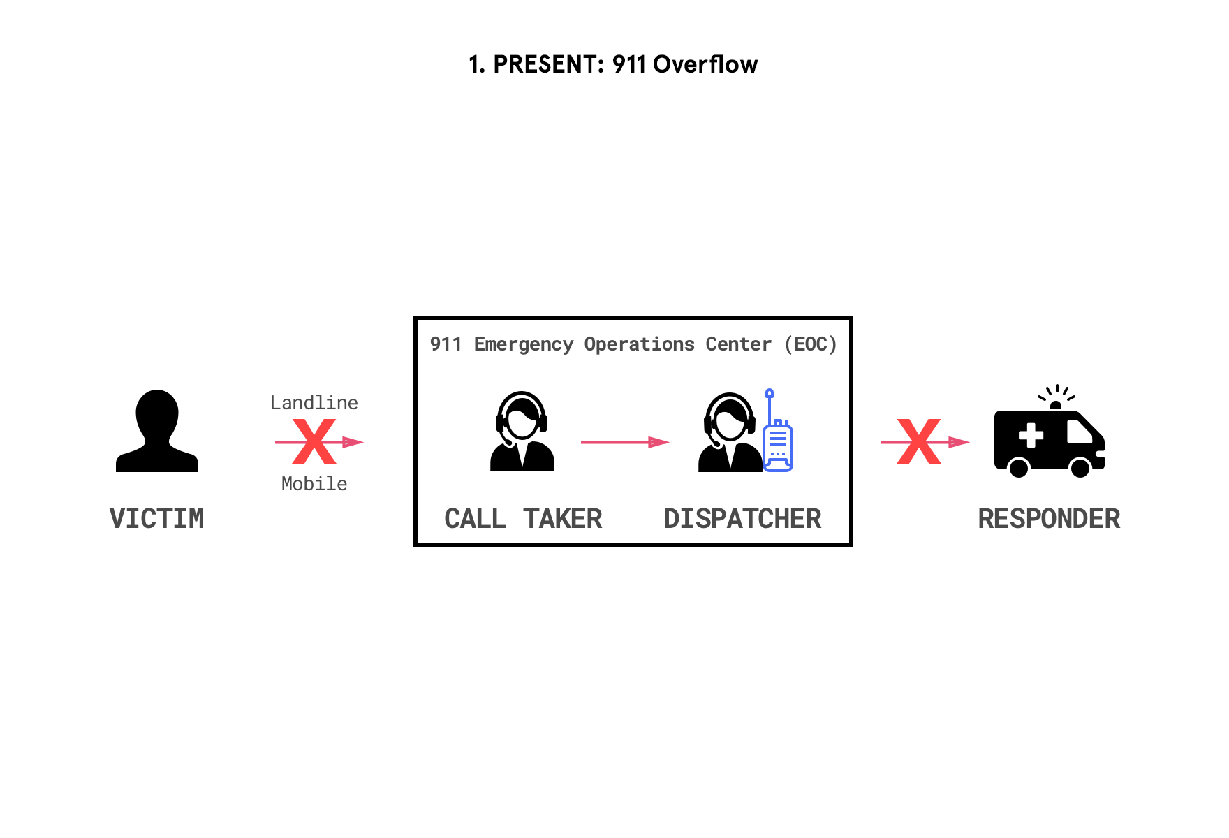
About this project
As the world becomes increasingly urbanized, with an estimated 70% of the world’s population projected to reside in urban areas by 2050, cities are becoming more and more vulnerable to natural and manmade disasters [1]. Damages from hurricanes or earthquakes are amplified by the infrastructural needs of large populations, and are further exacerbated by failure to deliver time-sensitive aid due to antiquated emergency response technology. With the increasing prevalence of natural and manmade disasters, cities are left facing economic, infrastructural, and logistical challenges of unprecedented scale. In just 2017 alone, the U.S. suffered $306 billion in economic losses from natural disasters.[2],[3] Amongst the many aspects of daily life disrupted before, during, and after large-scale catastrophes, our research uncovered a dire shortcoming in the ability of 911 emergency call centers to meet caller demand during these disasters. During Hurricane Harvey, 911 call centers experienced a 900% surge in the peak daily call volume, going from 8,000 calls to 80,000 calls within a 24-hour period, a spike emergency operation centers were far from being equipped to handle which left people on hold for over 45 minutes at a time.[4],[5] While 911 currently handles 240 million calls a year, much of its technological foundation still relies on technologies from the 60s, during the heyday of the Bell telephony system, and is subsequently poorly equipped to handle modern disaster relief efforts. Given resource constraints, even in times of normalcy, it would only take a few callers to overwhelm a region’s emergency communications centers and deny an entire area of emergency services. Public safety announcements have been successful in training people to use 911 services, and many people believe that 911 dispatchers can locate the caller, even during silent or distressed calls. However, the system is only designed to locate calls placed over landlines, even though 80% of calls are now made from mobile devices.[6] As a result, most calls have inaccurate location data, sometimes with deadly consequences caused by delays: the FCC estimates approximately 10,000 lives could be saved from improved location identification and the resulting faster response times.[7]
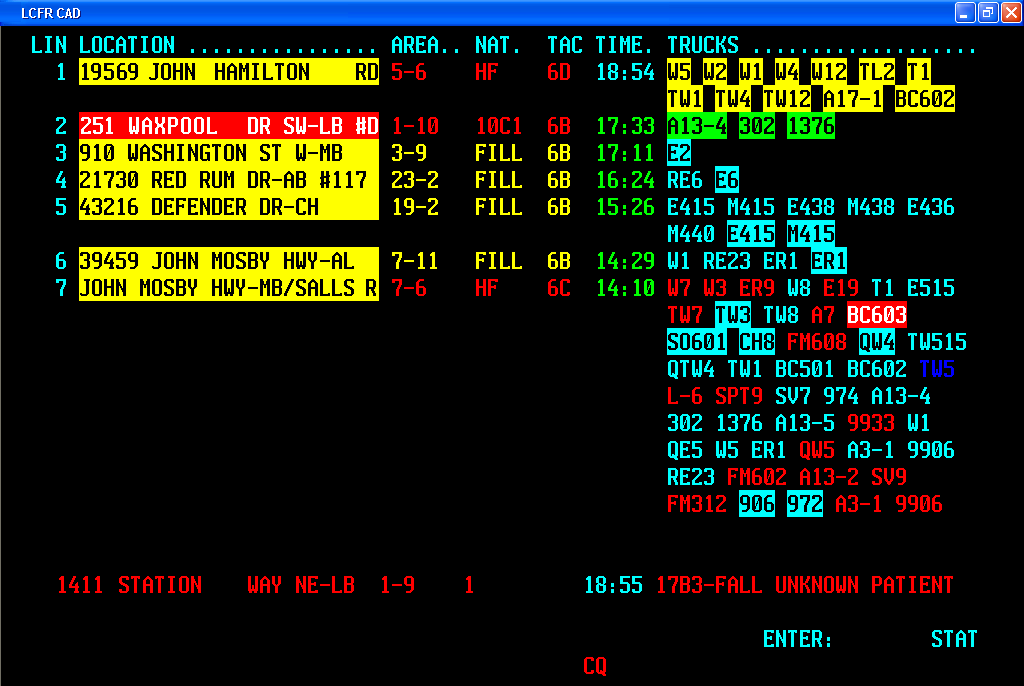
Existing 911 dispatch systems are primarily text-based and struggle to incorporate real-time, hyperlocal, demographically contextual content. The fidelity of information available to call-takers and dispatchers vary from center to center, with geospatial data sometimes constrained by text-based visualizations.
Source: Wikimedia Commons
Information Flow of a 911 Call
Our study of rescue requests made during Hurricane Harvey helped detail the information flow of an emergency call through the 911 ecosystem. Given the severe flooding and high volume of calls, civilians who were unable to reach official channels also requested help in informal overflow channels ranging from social media (Twitter, Facebook) to ad-hoc volunteer rescue organizations such as Team Rubicon, the Cajun Navy, and church groups.
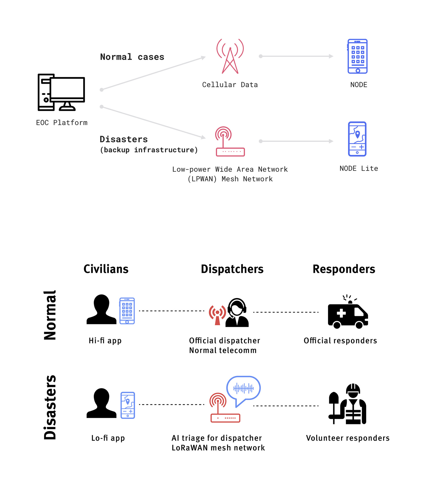
The underlying technologies of this dual-mode system runs in both normal connectivity and fall-back infrastructure.
-
Wireless mesh networks use routers linked to other nodes on the network, rather than to a single source like a cellular tower (star network). Even if one node goes down, packets can be rerouted through other users in the network and allow for communication within the network even if outside internet connection is severed.
-
LoRaWAN (long range, low-bandwidth wide area network) is a type of radiofrequency communication protocol that uses little energy and has a wide-enough range to connect entire communities. Because range trades off inversely with bandwidth, speeds will be slower on a RF network (as opposed to LTE), but are sufficient to send emergency data like GPS coordinates, unique user IDs, and time stamps. As long as the text-based data is passed between the end user and the EOC, responders can pinpoint calls for help with a database of user information.
Bottom: User groups
Node mobile app (high-bandwidth)
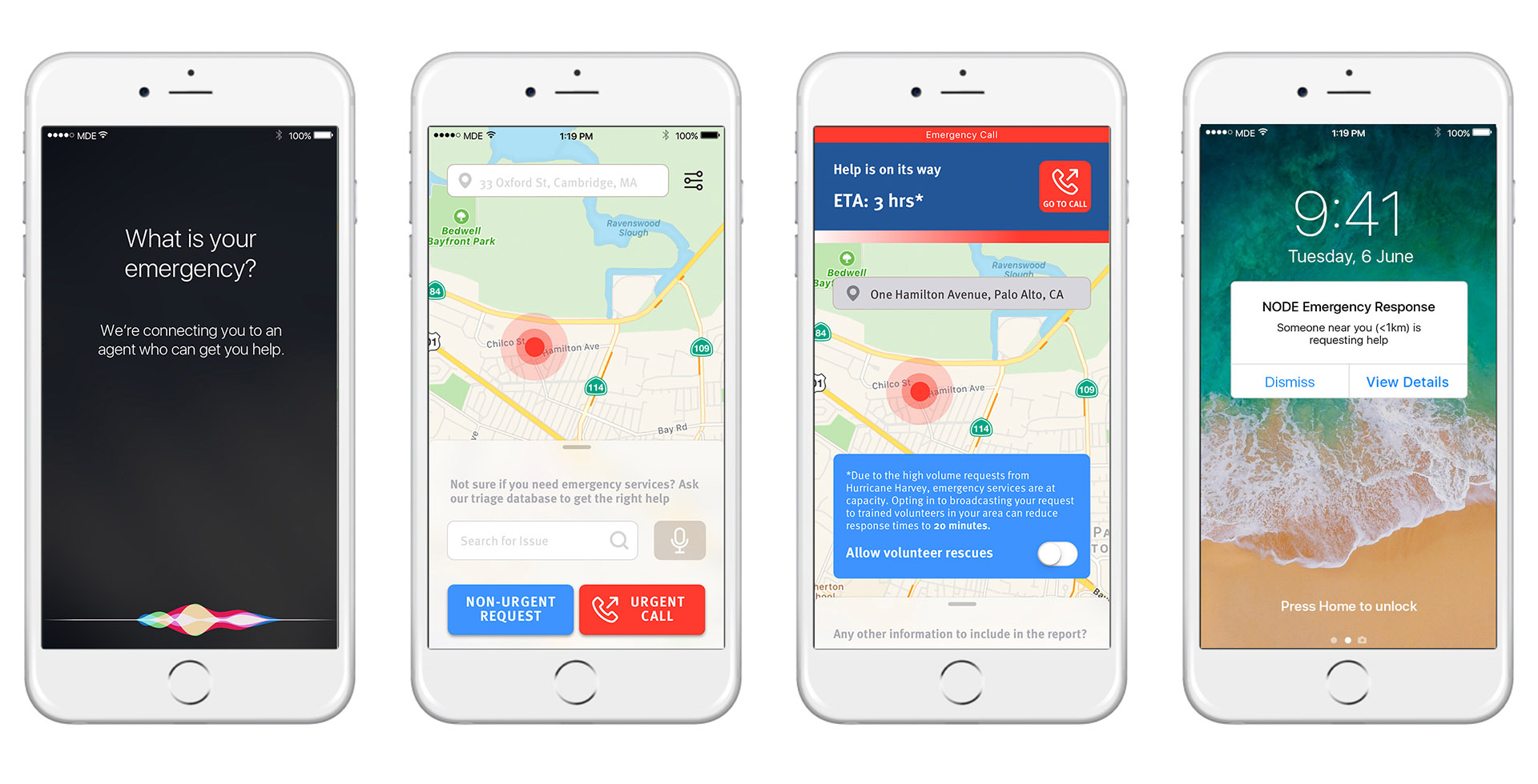
The high-fidelity version of the application prioritizes user experience, surfacing relevant emergency response action items in context. Upon opening the app, a user can:
- immediately make an Urgent Call (red button) to connect to a human operator,
- make a non-urgent request call (blue button) to an AI responder, or
- search for emergency services via text or voice input.
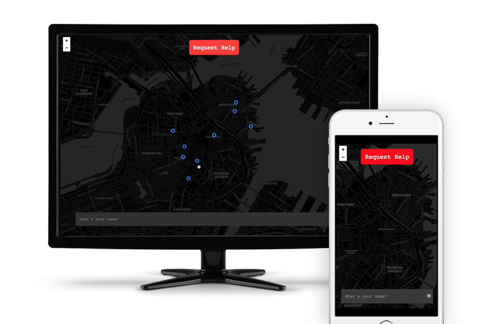
Node Lite app (low-bandwidth version)
The low-fidelity version of the app is designed for graceful degradation on slower bandwidth internet connections, transmitting primarily text-based content (unique user ID, name, request, GPS coordinates, etc) to emergency responders.
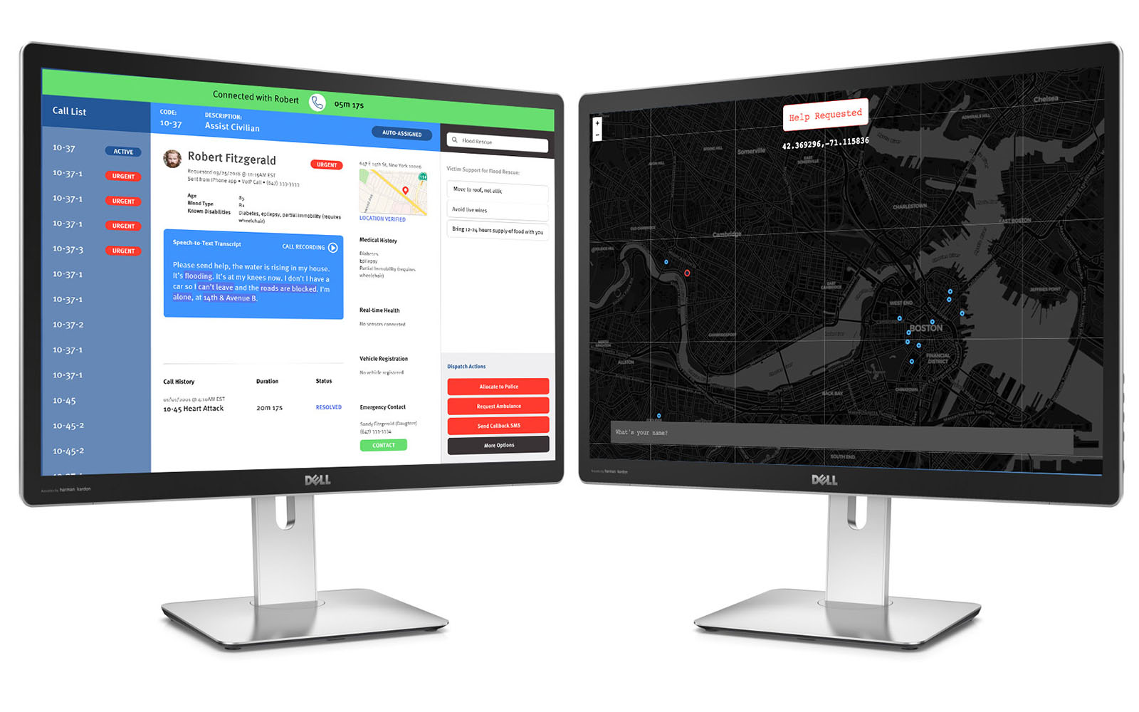
Emergency Operations Center (EOC) sample interface
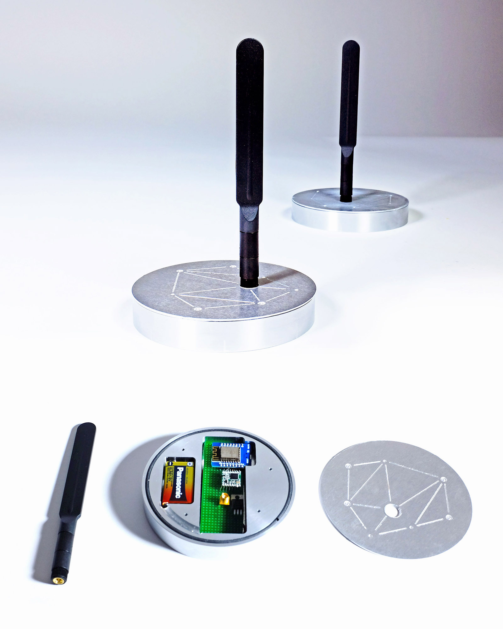
Finished Hardware Device
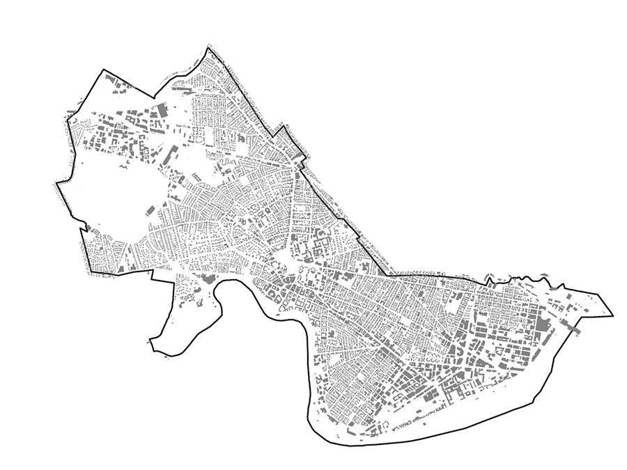
Case Study: Cambridge Pilot
As a first pilot, a city like Cambridge is ideal for Node: geographically contained enough to build a comprehensive mesh network with just 20 nodes, strong educational community to support device maintenance, innovative local government involved with Bloomberg’s 100 Resilient Cities initiative, and site of urban innovation incubators like the mayor’s New Urban Mechanics group, as well as a number of elderly and at-risk individuals in need of extra support during extreme weather conditions like floods, snowstorms, and heat waves.
Each node has an approximate coverage radius of 0.5 miles (around 805 meters), meaning that all of Cambridge, MA could be covered with just 20 nodes.
This map of city-owned utility poles offer a potential installation site: wireless hotspots must be hung in relatively high, unobstructed places to have the strongest coverage.